
Walk a Rexburg Street by Address
A useful Rexburg street directory search separates facts from clues. The county parcel roll identifies the owner of record, while MRGIS places that parcel on the street. A matching tax-mail and site address may suggest owner occupancy, but it does not prove who is inside the home. Voter data can add registered electors, subject to Idaho's protected-address rules. Deeds and older directories then extend the trail through time.
Work from the parcel outward. Keep the address, parcel number, legal description, and every date in separate notes so two similar names or lots are not joined by mistake.
- Enter the street address in the Madison County and Rexburg MRGIS viewer. Confirm the site address and parcel polygon.
- Read the owner, tax-mail address, parcel ID, subdivision, zoning, and legal-description fields. Click nearby polygons to continue by street.
- Use VoteIdaho for a person's own status or polling place. For a lawful voter-file need, ask the Secretary of State or Madison County Clerk about the current report process.
- Carry the legal description to the Madison County Recorded Documents portal. Open the newest deed, note its parties, and work backward.
- For an older household, consult the library and archive directory runs, Sanborn maps, newspapers, and census records rather than treating today's street text as timeless.
That sequence makes the street directory an evidence trail, not a claim that one public file lists every resident. If the goal shifts from addresses to one historical volume, the Rexburg city directory collections deserve their own focused search.
Rexburg Street Directory Parcel Fields
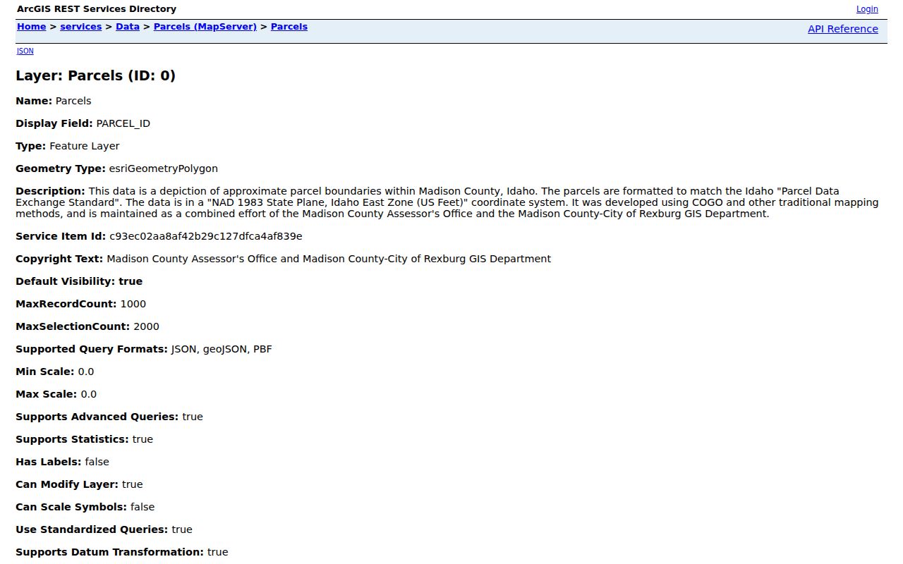
The Assessor links to MRGIS, whose official parcel and address services expose verified field names even when the visual map is hard to inspect. The map data is jointly maintained by Madison County and the City of Rexburg. It supports address, geometry, pagination, and distance queries, with a maximum record count of 1,000. The street directory should use the plain labels below and preserve the source values exactly.
| Field Group | Verified Labels | Street Use |
|---|---|---|
| Owner | OWNER1, OWNER2 | Names on the tax roll, not a full household |
| Site | SITE_ADD, SITE_CITY, SITE_ZIP | Physical location used for mapping |
| MAIL_ADD1/2, MAIL_CITY, MAIL_STATE, MAIL_ZIP | Tax correspondence, which may be elsewhere | |
| Parcel and legal | PARCEL_ID, DESC1-DESC5, SUBDIV, LOCATION | Stable bridge to plats and deeds |
| Place context | JURISDICTION, TAXCODEARE, ZONING | City, county, tax-area, and zoning clues |
| Size and value | ASR_ACRES, GISACRES, GISSQFT, TOT_VALUE | Assessment and map context, not resident data |
The current viewer offers “Find address or place.” Exact live field labels were not captured, so do not assume a public owner-search control. The REST schema is the verified source. The parcel service page also shows its polygon geometry and query abilities.
The parcel service fields can be inspected directly at the source shown here.
Address Records Across Rexburg Streets
No single Rexburg record proves a whole household. Each keeper answers a narrower question, and the access path changes with the record. Online tools are the first stop, not the only stop. Counter help, written requests, library collections, and archive reference service remain part of a complete search by address.
| Address Source | Custodian | What It Can Establish | Access Route |
|---|---|---|---|
| Parcel roll | Madison County Assessor | Owner, site and mailing address, parcel, value | MRGIS, Assessor counter, phone |
| Parcel and address map | Joint county-city GIS | Lot shape, nearby parcels, subdivision, zoning | Viewer, REST services, GIS staff |
| Deed or plat | Madison County Clerk/Recorder | Parties, instrument, date, legal description, image link | Web index, recorder counter, county request |
| Voter record | Idaho SOS and Madison Clerk | Specified registered-elector fields, with protected exceptions | VoteIdaho, state report request, county office |
| Planning file | Rexburg Planning/Building | Applicant, legal interest, plans, project chronology | Application pages and city records request |
| Historic directory and map | Libraries and archives | Past address entries and dated block context | Reading rooms, catalogs, microfilm, reference request |
When a portal fails, call the Assessor at 208-359-6200 Option 3, city GIS at 208-372-2150, or the city clerk at 208-359-3020. The Assessor is at 134 E Main. Its current page and an older exemption form show different phone numbers, so verify before relying on the form footer.
Note: A property owner's tax-mail address can help trace a deed, but it does not establish who occupies the Rexburg site.
Read Rexburg Address Terms
Four terms keep a Rexburg by-address search on track. They explain why the street on a piece of mail may not be the best key for an old deed or map.
- Parcel
- A mapped unit of land with its own identifier. One mailing address may relate to more than one parcel.
- Situs address
- The physical property address stored as SITE_ADD, unlike the owner's tax-mail address.
- Plat
- A recorded map that lays out subdivision lots, blocks, streets, and related land detail.
- Criss-cross directory
- A directory arranged by address or telephone number instead of only by surname. Exact Rexburg reverse runs have not been verified.
The legal description is often the strongest bridge. MRGIS stores DESC and subdivision fields, while the recorder accepts a Description search. A lot and block can survive a changed street format. If records conflict, preserve both versions and ask GIS or the recorder which one controls.
Two Addresses in Rexburg Records
Rexburg parcel data often shows both a site address and a mailing address. The site field points to the land. The mail field tells where the Assessor sends tax correspondence. An out-of-town mail address may belong to an owner who does not live at the Rexburg parcel. A match between the two is still only an owner-occupancy clue unless another record supports it.
The Assessor's homeowner-exemption form asks for an owner of record, property address, mailing address, parcel number, legal description, prior address, and an owner-occupancy statement. Those questions show why address types matter. They do not turn the exemption file into a public resident roster. Sensitive form fields such as identification numbers and dates of birth are not street-directory material.
This local two-address pattern is an important guardrail. Use mailing data to follow an owner or correct a deed search, but use SITE_ADD and the polygon when the task is to walk the Rexburg street itself.
Rexburg Parcel Address Layer
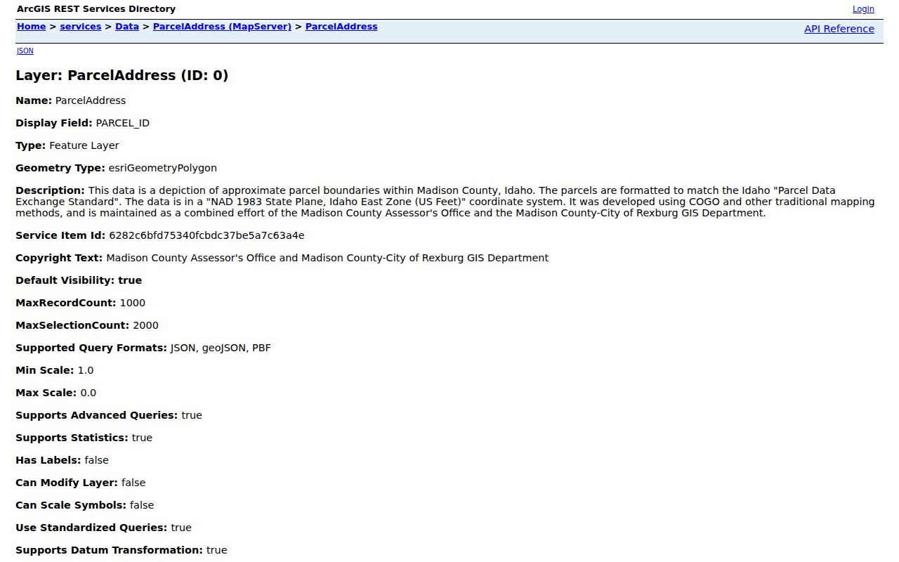
The separate MRGIS ParcelAddress service repeats owner, mailing, site, parcel, subdivision, zoning, and value fields. Its metadata also includes stewardship and update fields. Address data supports taxation, emergency response, and statistics, and local item information says subdivision plats and address-request forms supply the source material.
Open the official ParcelAddress layer before relying on a stored street value.
Planning and zoning coordinators maintain address context with the joint GIS team. For an alias, a disputed number, or a map mismatch, city GIS staff are the proper fallback. No authoritative citywide renumbering table was found, so an old and new number should never be joined by guesswork.
Trace Rexburg Streets Through Deeds
MRGIS supplies the land key; the recorder supplies dated instruments. Search the Recorded Documents portal with a short subdivision or section phrase from the legal description. The instructions say all entered criteria must match, and too much description can narrow away a useful result. The document-type filter cannot be used alone.
The form accepts Instrument Number, Document Type, Name in Last, First order, Description, and paired From and To dates. An instrument number overrides all other criteria. Results can show the instrument, recorded date, page count, recorded-from party, associated name, type, and description. Open a deed, write down the grantor and grantee, then search the prior party in an earlier date window. If an image or book is absent, contact the Madison County Clerk/Recorder or consult FamilySearch county images.
The online cutoff is not published. Live results included a 1900 survey and 1914 material, but Madison County did not begin office operations until 1914. For earlier Rexburg land, ask whether the trail continues in Fremont County books.
Rexburg Plats Mark Street Change
Plats connect a street name to a subdivision, lot, block, recorded date, and instrument number. The MRGIS subdivision layer carries recorded name, date, instrument, and jurisdiction. City plat review also calls for legal descriptions, vicinity maps, infrastructure, and covenant material. Those files help explain when a block appeared or why a parcel sits in the city impact area.
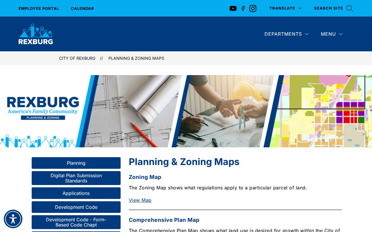
The Rexburg planning and zoning maps gather city, county, and impact-area context.
For permit or development files, use the city's application catalog and public-record request. No searchable public permit index or complete annexation chronology was located. Ask for a named address, parcel, subdivision, project, or date range so staff can search a defined file set.
Rexburg Voter Address Evidence
Idaho voter material can add a registered elector to a street trail, but it must be read within strict limits. The public database may include name, physical and mailing addresses, county, gender, age, optional phone, party, and participation history. It does not reveal ballot choices, a full birth date, driver-license number, Social Security digits, signature, or the physical application.
VoteIdaho provides individual status and polling tools. Its current pages depend on JavaScript and did not expose stable field labels during research, so no form fields should be invented. A full report request routes through the Idaho Secretary of State's public-records page or the Madison County elections office at 134 E Main, Suite 102, 208-359-6244. Idaho Code section 74-120 limits using public records to create mailing or telephone lists.
Protected residents may be omitted. Safe at Home provides a substitute mailing address and confidential voter-registration path for eligible survivors. A missing Rexburg address is not proof that someone has moved.
Older Rexburg Streets Need Maps
For an early street directory question, pair address sources rather than forcing an old entry into today's map. Library of Congress Sanborn sheets cover Rexburg in 1903 and 1918. They show street, lot, block, building form, use, and fire-service context, but not the names of occupants. Regional directories at the Idaho State Historical Society cover selected years from 1911-12 through 1941, while University of Idaho holdings include Rexburg runs in the 1950s.
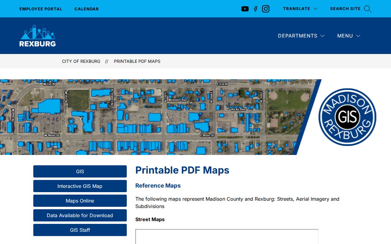
The Madison Library District has an Idaho Collection, public computers, and LiLI databases, but its public page does not list exact directory runs. BYU-Idaho holds local newspaper microfilm. Ask archive staff to check street or reverse sections, since an exact Rexburg criss-cross run was not verified. The modern Rexburg printable map catalog is another useful comparison point.
Note: No official Rexburg street-renaming or renumbering table was found, so match old addresses through legal descriptions, plats, and dated maps.
Growth Changed Rexburg Street Context
Rexburg grew from 25,484 residents in 2010 to 39,409 in 2020, with a 2025 estimate of 40,334. The city's state-of-the-city account describes 83 miles of public streets. Those figures do not identify anyone, but they explain why subdivisions, annexations, and address layers matter in a current street directory.
Postal geography adds another split. A Rexburg mailing city or ZIP does not prove that a parcel is inside the incorporated city. MRGIS jurisdiction fields and planning impact-area maps answer the government-boundary question. USPS answers the delivery question. The city clerk holds annexation records, while planning and plat files can date a subdivision.
This geography is the Profile 3 interest layer: it turns an address into a precise jurisdiction check. The parcel, not the postal label alone, tells which local office is likely to hold the next Rexburg record.
Limits of Rexburg Street Records
A Rexburg street directory cannot list every renter, child, guest, or household member. Utility and delivery customer data are not public resident rolls. Federal law restricts personal motor-vehicle data. Safe at Home and other protected-address rules can shield a location, and sealed records remain closed. A parcel owner may live elsewhere, while a voter record covers registered electors only.
Official records also have dates and scope. An assessment roll, deed index, voter report, and old directory may describe different moments. Label each finding with its custodian, date, and whether it is an index, image, or current status. Do not merge two people because their names and city match.
Lawful use. Rexburg address records are for personal research, family history, civic questions, and scam checks. Never use them to stalk, harass, threaten, or expose a protected address.
For a correction, contact the keeper of the source record. The Idaho Attorney General's Public Records Law materials explain the state request framework, while the Rexburg Laserfiche form handles city-held documents. The best street search remains narrow, dated, and tied to the office that created the record.